Connect With Us
Hiking & Backpacking
Hiking & Backpacking
HIKE & BACKPACK BAKER COUNTY
As the inaugural winner in 2008, Florida was named the "Best Trails State" in the nation by American Trails. The prestigious award recognized the contributions of local volunteers, professionals, government agencies and others who worked collectively to create Florida's trail system for all to enjoy. Statewide the Florida Trail provides excellent opportunities for hikers and backpackers to see the "Real Florida" and enjoy it in the wild.
HIKING THE OSCEOLA NATIONAL FOREST
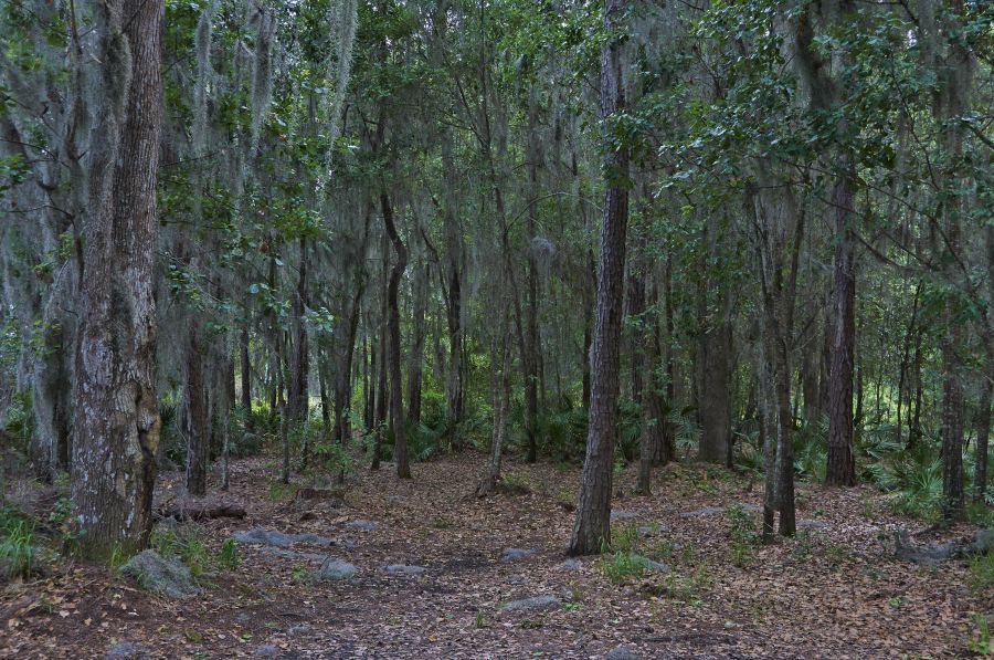
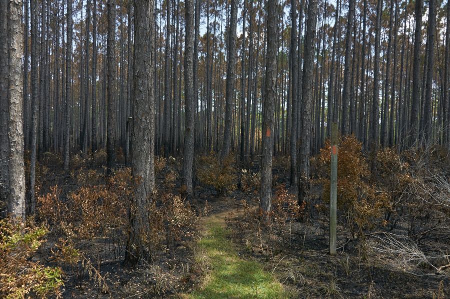
Although Osceola is the smallest of Florida's three National Forests, it contains hundreds of miles of natural trails that wander through over 200,000 acres of mesic flatwoods and inland forested swamps. In addition, a 23 mile section of the Florida National Scenic Trail await visitors with noted sections that include:
- Olustee Battlefield Trail
- Trampled Track Trail
- Mt. Carrie Wayside
- Fanny Bay Trail
- Nice Wander Loop
- Florida National Scenic Trail
The park contains numerous boardwalks that offer an elevated view of floodplain swamps and wetland habitat. Shelters are located along the Florida National Scenic Trail and are available on a first come first served basis for primitive camping.
Park trails in the Osceola National Forest pass through several historically significant areas like the Olustee Battlefield where the most significant battle of the American Civil War occurred in 1864. Interpretive trails and loops are used at Olustee and throughout the park to tell the stories. One of the most interesting trailheads is located at the westbound Sanderson Rest Area on I-10. Travelers can follow detailed signage along a 1.1 mile loop that highlights the forest's long-needle pine flatwoods, seepage bogs, floodplain forests and cypress dome swamps.
THINGS TO DO ALONG THE OCEOLA TRAIL
The many and varied outdoor activities you can enjoy in Baker County are linked by roads and paths to form The Osceola Trail. A concept developed by Baker County government and the Baker County Chamber of Commerce, The Osceola Trail connects sites once inhabited by Osceola and the Seminole Indians along the St. Marys River, and in St. Marys Shoals Park, John M. Bethea State Forest, and Osceola National Forest. The map in this Visitor's Guide has full information on how to travel the trail and access the sites.
OTHER BAKER COUNTY TRAIL SYSTEMS
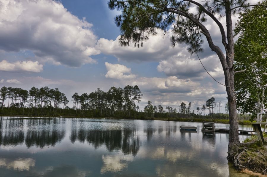
If you prefer a more primitive hiking or backpacking adventure, the 37,736-acre John M. Bethea State Forest features 2.9 miles of frontage along the St. Marys River and numerous black water creeks and streams. The park creates a natural wildlife corridor Nestled between the Osceola National Forest and the Okefenokee National Wildlife Refuge, the park creates a natural wildlife corridor for Florida black bears and river otters as well as bird species that include hawks, wood storks, bald eagles, grasshopper sparrows and sandhill cranes. Visitors often report sightings of alligators, turkeys, white-tailed deer, gopher tortoises, and numerous species of amphibians and reptiles.
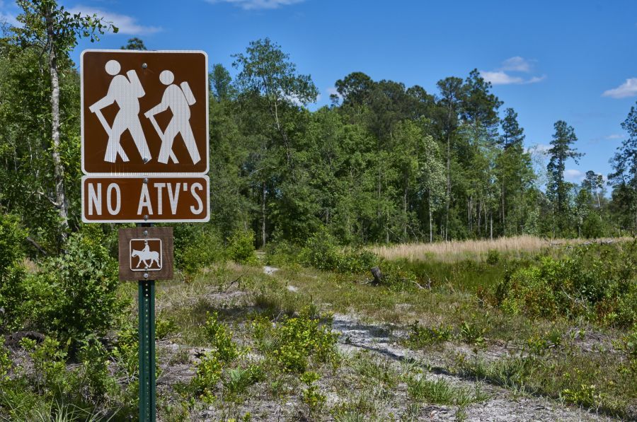
St. Marys Shoals is a 2568-acre park located north of Macclenny on the Florida/Georgia border. With nearly two miles of St. Marys River frontage, hikers and backpackers have public access to the sandy shoal banks of one of the nation's purest tea-stained rivers that flows northeast from the Okefenokee Swamp to the Atlantic Ocean. Backpackers, cyclists and hikers can use the trails on the east side of the park to explore the scenic forest along the river as well as Cedar Creek. Restrooms and picnic facilities are available at the trailhead parking lot. NOTE: The west side of St. Mary Shoals Park is dedicated to ATVs and other all-terrain vehicle usage.